Guide to Creating a GPS Map
I. OVERVIEW
1. What is a GPS Map?
A GPS Map is a type of digital spatial map based on real-world geographic coordinates (Longitude, Latitude) determined through satellite positioning systems and digital mapping services.
Unlike a VPS Map, which requires capturing images of the physical environment and processing them to generate a Point Cloud, a GPS Map allows users to immediately create an AR space by selecting a geographic location on a satellite map.
2. Comparison Between GPS Map and VPS Map
To select the appropriate map creation method for a project, users can refer to the comparison below:
| Criteria | GPS Map | VPS Map |
|---|---|---|
| Operating Environment | Outdoor, open areas | Indoor or outdoor areas with clearly identifiable structures |
| Positioning Accuracy | Relatively accurate, with approximately 3–10 m error depending on the smartphone’s GPS | High accuracy, down to the centimeter level using computer vision |
| Input Data | Only requires a name and address / coordinates | Video recorded using a phone camera or 360 Camera |
| Creation Time | Instant — can be used immediately | Requires approximately 15–45 minutes for the server to calculate the Point Cloud and 3D mesh |
| Creation Cost | Completely free | Uses the service package / VPS License quota |
| Typical Applications | Outdoor events, festivals, large-scale tours | Step-by-step AR navigation (Wayfinding), fixed 3D content placement |
3. When Should You Choose a GPS Map?
A GPS Map is suitable for cases where:
-
You need to create an AR space immediately without spending time recording videos on-site.
-
The location is outdoors, such as:
- Parks.
- Public squares.
- Stadiums.
- Pedestrian streets.
- University campuses.
- Tourist attractions.
Note: GPS Maps are most suitable for outdoor areas where GPS signals can be received relatively reliably.
II. GUIDE TO CREATING A GPS MAP ON XENSE PORTAL
The process of creating a new GPS Map consists of 4 steps:
- Access Spatial Map.
- Select the GPS Map creation method.
- Enter the name and select the location.
- Complete the creation process.
Step 1: Access Spatial Map on Xense Portal
- Open a browser and log in to the XenseAR Creator Portal using your personal account.
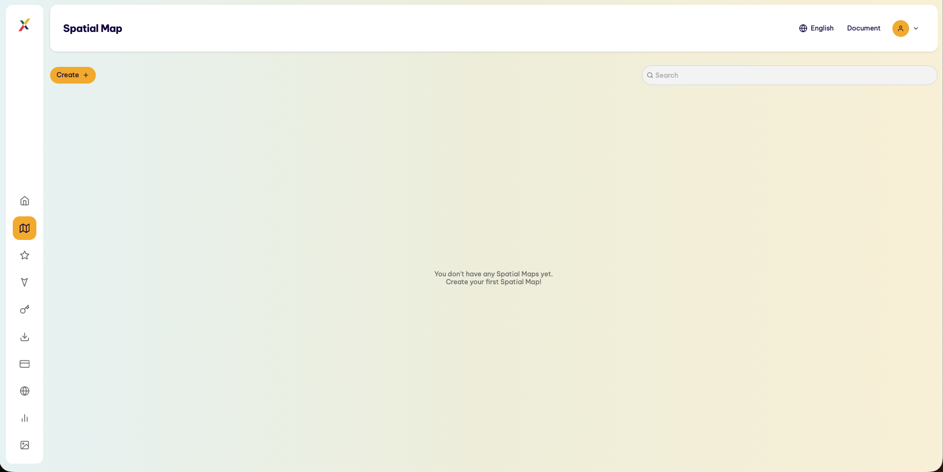
- On the left Sidebar, select Spatial Map.
- On the spatial map list interface, click the Create (or Tạo mới) button in the upper-left corner.
Step 2: Select the GPS Map Creation Method
-
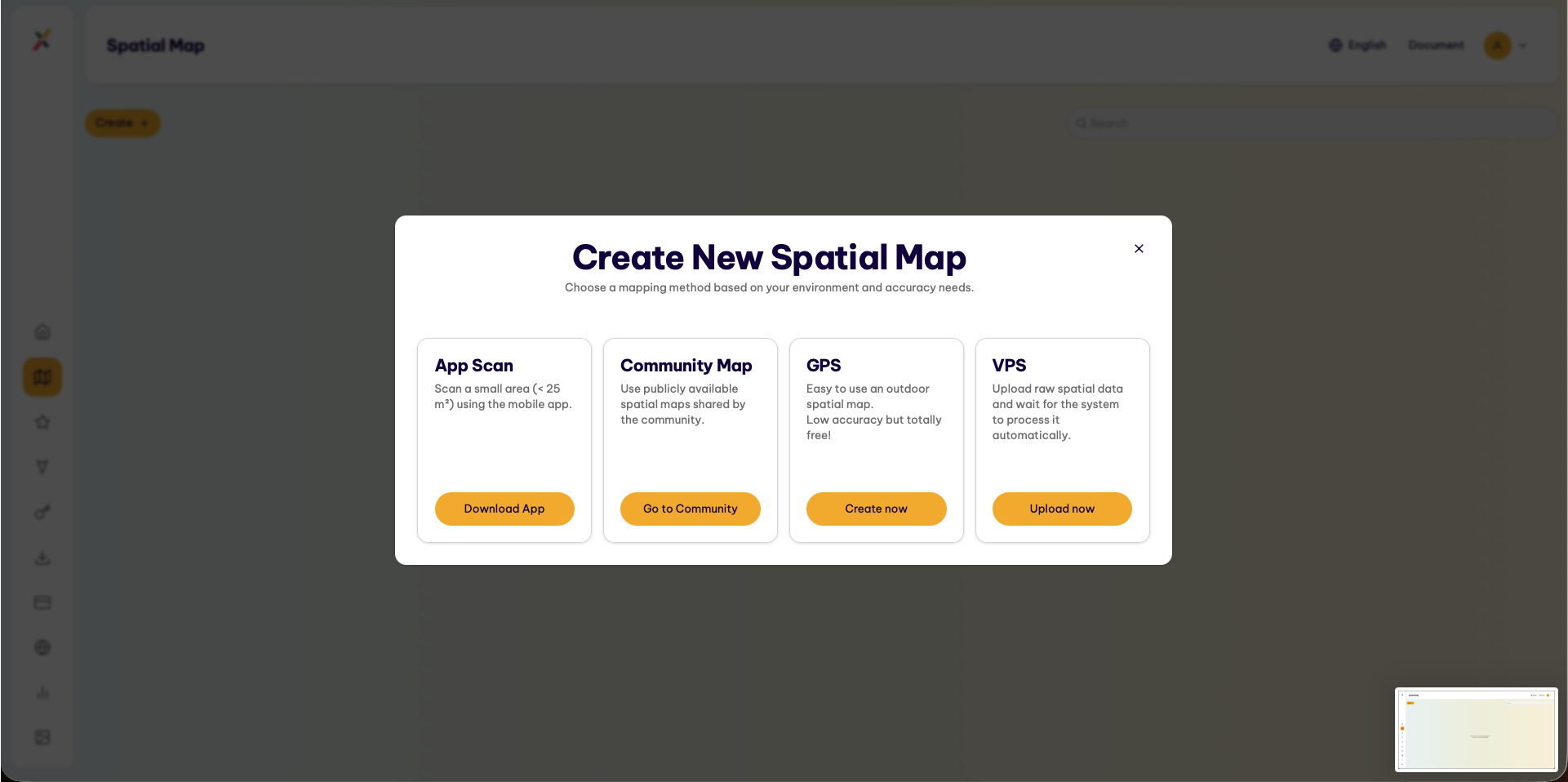
The system displays the Create New Spatial Map window with the following creation methods:
- App Scan
- Community
- Map GPS
- VPS
-
In the GPS tab, click Create now.
Step 3: Configure Information and Pin the GPS Map Location
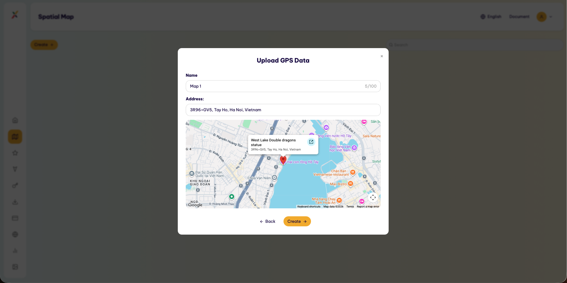
The system opens the Create GPS Outdoor Map modal.
Enter the following information:
1. Name Field
Enter the name of the GPS Map.
The name should be concise, easy to identify, and clearly indicate the location or area represented by the map.
2. GPS Location Field
Enter or select the location address for the GPS Map.
Users can select a location directly on the map to determine the geographic coordinates of the area.
3. Confirm Creation
Review the map name and GPS location.
After verifying that the information is correct, click Create to create the GPS Map.
Step 4: Complete and Verify the Newly Created Map
After clicking Create, the system immediately saves the information and redirects the user to the Spatial Map management page.
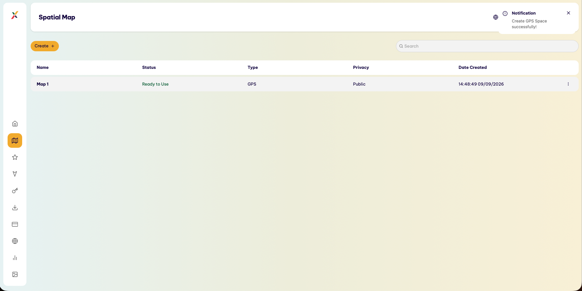
Users can check the newly created GPS Map in the map list.
Check the following key information:
- Map Name.
- Map Type.
- GPS Location.
- Map Status.
After the GPS Map has been created successfully, it can be used as a reference space for AR content suitable for the deployment area.