Viewing and Searching Spatial Map Information
1. Viewing the Spatial Map List
Access the Spatial Map function.
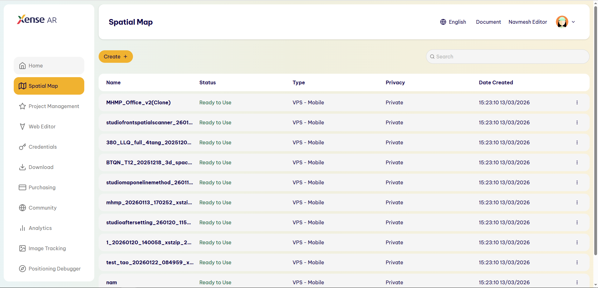
The system displays a list of created Spatial Maps.
Each Spatial Map includes the following information:
- Name: The name of the Spatial Map.
- Status: The processing status of the Spatial Map.
- Type: The type of Spatial Map.
- Privacy: The access level of the Spatial Map.
- Date Created: The date and time when the Spatial Map was created.
2. Spatial Map Status
The system may display the following statuses:
- Queued for Processing: The Spatial Map is queued and waiting to be processed by the system.
- Ready to Use: The Spatial Map has been successfully processed and is ready for use.
- Failed: Spatial Map processing was unsuccessful.
3. Spatial Map Type
Depending on the data creation method, a Spatial Map may have one of the following types:
- VPS - Mobile
- VPS - Cam360
- VPS - Community
4. Privacy
A Spatial Map has two access modes:
- Private: Can only be used within the scope of access granted by the system.
- Public: The Spatial Map is publicly available for use according to the system’s Public access mechanism.
5. Searching for a Spatial Map
In the Search field above the list:
- Enter the keyword you want to search for.
- The system filters the Spatial Map list based on matching information.
- Clear the keyword to return to the full list.
Last updated on